

290 items
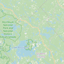
L'aire sauvage de la Rivière-Shelburne (anglais : Shelburne River Wilderness Area) est une réserve naturelle de la Nouvelle-Écosse. Cette réserve protège le cours inférieur de la rivière Shelburne, qui est reconnue comme rivière du patrimoine canadien. On retrouve dans la réserve des forêts anciennes, de multiples lacs, des milieux humides et des ruisseaux.
Summerville Beach is a community in the Canadian province of Nova Scotia, located in the Region of Queens Municipality.
Wellington is a community in the Canadian province of Nova Scotia, located in the Region of Queens Municipality .
Street address: 145 Old Bridge Street (from Wikidata)
website: http://www.southshorepubliclibraries.ca/locations-hours-contact/
Granite Village, Nova Scotia is a community of the Municipality of the District of Shelburne in the Canadian province of Nova Scotia.
Port Mouton is a small village along Highway 103 on the southwest coast of Region of Queens Nova Scotia, Canada. It is about ten miles from Liverpool, the nearest significant community, and 160 kilometres from Halifax. The local residents pronounce the town's name 'Port Mah-TOON'.
West Caledonia is a community in the Canadian province of Nova Scotia, located in Queens County .
Port Medway is a community in the Canadian province of Nova Scotia, located in the Region of Queens Municipality.
CJQC-FM, branded as Queens County Community Radio is a Canadian radio station that broadcasts at 99.3 FM in Liverpool, Nova Scotia.
Bristol is a community in the Canadian province of Nova Scotia, located in the Region of Queens Municipality .
Fort Morris was a British fort or blockhouse built during the French and Indian War, located at Liverpool, Nova Scotia. The fort was located at present-day Fort Point Lighthouse, while a surrounding blockhouse was at the corner of Lawrence and Wolfe Streets. (In 1762, the blockhouse was occupied by Lieut. Jonathan Diman Ebenezer Dexter). The fort was completed shortly after Liverpool was established and the Halifax Treaties were signed (1759-1760). The fort was a local militia five-gun earthwork battery. Fort Morris was named after Surveyor General Charles Morris, who designed the layout of the town. (The fort was built the same time as Fort Ellis and Fort Belcher.)
Street address: 162 Long Cove Road (from Wikidata)
Street address: 59 Gorham Street, Liverpool, NS B0T 1K0 (from Wikidata)
website: http://www.astortheatre.ns.ca
Greenfield is a community in the Canadian province of Nova Scotia, located in the Region of Queens Municipality. The sawmill in Greenfield, founded in 1832, is one of the oldest family-run sawmill businesses in North America. Until 1850 the region was occupied mostly by the Mi'kmaq of the Algonquin tribe, who seasonally settled the area below the lakes on either side of what is now called the Medway River and was known by the Mi'kmaq as Wigadoon.
Street address: 5060 Highway 210 (from Wikidata)
website: http://www.southshorepubliclibraries.ca/locations-hours-contact/
Low Landing is a community in the Canadian province of Nova Scotia, located in the Region of Queens Municipality.
The Meguma terrane, also known as Megumia, is a terrane exposed in southern Nova Scotia, that became joined to the present North American landmass as part of the Appalachian orogeny.
Brookfield Mines is a community in the Canadian province of Nova Scotia, in the Region of Queens Municipality .
Pleasant River is a community in the Canadian province of Nova Scotia, located in the Lunenburg Municipal District in Lunenburg County.