

127 items
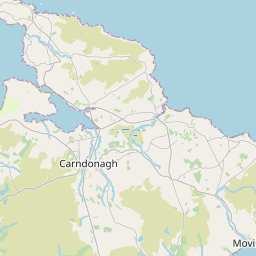
Inishowen (Irish: Inis Eoghain, meaning 'island of Eoghan') is a peninsula in the north of County Donegal in Ireland. Inishowen is the largest peninsula on the island of Ireland.
Malin (Irish: Málainn) is a village in County Donegal, Ireland, situated 6 km (4 mi) north of Carndonagh. A further 13 km (8 mi) north further is Malin Head, the most northerly point of the island of Ireland. It was a planned settlement plotted around a triangular green. Malin won the Irish Tidy Towns Competition in 1970 and 1991.
Urris (Irish: Iorras) is a valley to the west of the parish of Clonmany, in County Donegal, Ireland. It comprises the townlands of Crossconnell, Dunaff, Kinnea, Leenan, Letter, and Urrismenagh. It sits on the eastern side of Loch Swilly and it is bounded to the south-east by the Urris hills, and to the east by Binion hill. To the north, there is Rockstown bay and Tullagh peninsula. There are two entrances to Urris; the Gap of Mamore, and Crossconnell.
German submarine U-1009 was a Type VIIC/41 U-boat of Nazi Germany's Kriegsmarine during World War II.
Clonca Church & Cross, is a historic monument located in Inishowen, County Donegal. It is one of the most important and popular historical sites in Inishowen. At 54°43′05″N it is the northernmost of Ireland's National Monuments.
The Isle of Doagh (Irish: Oileán na Dumhcha, meaning "Isle of the Dune"; also known in English as Doagh Isle or Doagh Island) is a small peninsula in the north of Inishowen on the north coast of County Donegal in Ulster, Ireland. It once was an island. Over time, the channel between Doagh and the mainland silted up and it became joined to the mainland. Nevertheless, the area continued to be referred as the Isle of Doagh or Doagh Island. The area comprises five townlands; Ballymacmoriarty, Carrickabraghy, Carrowreagh, Fegart and Lagacurry. Doagh Island is very near the village of Ballyliffin.
Inishtrahull Lighthouse is the northerly most lighthouse in Ireland located on the Inishtrahull Island off the coast of County Donegal. Coupled with the lighthouse on Tory Island they form the two main landfall lights for shipping from the Atlantic rounding the north coast of Ireland, and navigation to local shipping. Work on the first lighthouse, situated at the east end of the island began in 1812, primarily due to Royal Navy ships using Lough Foyle.
Admiralty number: A6164
Kinnagoe Bay (Irish: Bá Chionn an Ghabha) is a beach in Inishowen, County Donegal, Ireland. The wreck of a Spanish Armada ship, La Trinidad Valencera, was discovered in the bay in 1971. The sinking of this ship, on 16 September 1588, is memorialised by a plaque in the area. The beach is accessible by a road from the top of the hill. There is a small car park at the beach which gets very busy during the summer. It is one of the places of interest on the Inishowen 100 scenic route.
Inishowen East (Irish: Inis Eoghain Thoir), also called East Inishowen or Innishowen East, is a barony in County Donegal, Ireland. Baronies were mainly cadastral rather than administrative units. They acquired modest local taxation and spending functions in the 19th century before being superseded by the Local Government (Ireland) Act 1898.
Lenan Head Fort, Lough Swilly, Inishowen, County Donegal was built in 1895, initially with three 9.2 inch Breech Loading (BL) guns. Following recommendations of the Owen Committee in 1905, it was refitted in 1911 with two newer Mark X 9.2 inch models. Both guns were operational during the First World War.
The R240 road is a regional road in Ireland, located on the Inishowen Peninsula, County Donegal.
The R838 road is a regional road in Ireland, located in County Dublin.
The R244 road is a short regional road in Ireland, located in County Donegal.
The R243 road is a short regional road in Ireland, located in County Donegal.
The Cabry River is located in north County Donegal, Ireland. It flows into Lough Foyle after passing under the late-18th century bridge at Quigley's Point, known locally as "Carrowkeel". The mouth of the river is in Quigley's Point, a village within the nearby townlands of Cabry, Carrowkeel, Gortanny, Magheralahan, and Meenavanaghan, all in County Donegal.
Street address: Carndonagh Community Library, Public Services Centre, Carndonagh, Co. Donegal, F93 NR70, Ireland (from Wikidata)
Urris Hills är kullar i republiken Irland. De ligger i grevskapet County Donegal och provinsen Ulster, i den norra delen av landet. Kullarna är täckta av hed.
Natura 2000 site ID: IE0000168
Natura 2000 site ID: IE0002012
Dunaff Head är en udde i republiken Irland. Den ligger i grevskapet County Donegal och provinsen Ulster, i den norra delen av landet, 230 km norr om huvudstaden Dublin.
Raghtin More (Irish: Reachtain Mhór) or Slieve Keeroge is a mountain with a height of 502 metres (1,647 ft) in Inishowen, County Donegal, Ireland. There is a megalithic cairn on its summit, which can be climbed from Mamore Gap. From the summit there is a view of Lough Swilly and the coast stretching to Malin Head.