

100 items
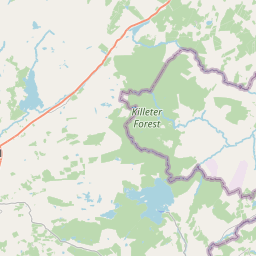
The Blue Stack Mountains or Bluestack Mountains, also called the Croaghgorms (Irish: na Cruacha Gorma, meaning 'the blue stacks'), are the major mountain range in the south of County Donegal, Ireland. They provide a barrier between the south of the county, such as Donegal Town and Ballyshannon, and the towns to the north and west such as Dungloe and Letterkenny. The road between the two parts of the county goes through the Barnesmore Gap.
MacCumhaill Park (Irish: Páirc Sheáin Mhic Cumhaill) is a GAA stadium in Ballybofey, County Donegal, Ireland.
Castlefinn railway station served the village of Castlefin in County Donegal, Ireland.
Glenmore railway station served the village of Glenmore, County Donegal in County Donegal, Ireland.
Killygordon (Irish: Cúil na gCuirridín) is a small village in the Finn Valley in the east of County Donegal, Ireland. As of 2022, the population was 716. It is located on the N15 between Stranorlar and Castlefin. The separate hamlet and townland of Crossroads, usually known as The Cross, lies half a mile from Killygordon. The River Finn passes by the village on its way towards its confluence with the River Mourne and the River Foyle.
Liscooly railway station served the village of Liscooly in County Donegal, Ireland.
Meenglas Halt railway station served Meenglas near Stranorlar in County Donegal, Ireland.
Stranorlar railway station served the village of Stranorlar in County Donegal, Ireland.
Raphoe South (; Irish: Ráth Bhoth Theas), or South Raphoe, is a barony in County Donegal, Ireland. Baronies were mainly cadastral rather than administrative units. They acquired modest local taxation and spending functions in the 19th century before being superseded by the Local Government (Ireland) Act 1898.
Cloghan railway station served the village of Cloghan in County Donegal, Ireland.
The Donegal Community Stadium is a stalled construction project in Stranorlar, Ireland. The stadium was initially intended to have a capacity of 6,600 spectators, and proposed as an association football venue to replace Finn Park as the home stadium of Finn Harps F.C. Planning permission was granted in June 2007, and ground breaking was started in May 2008. After intermediate delays, work recommenced in late 2011 with foundations in place. The project was again delayed in October 2012, with "minimal work" undertaken between 2014 and 2024, pending additional funding. In April 2021, a "provisional allocation" of government funding was reportedly announced. By May 2022, the development plans were further revised and scaled-back to account for inflation and the increased cost of building works and materials. While this scaled-back proposal was reportedly given the "green light" in August 2022, a "revised 5,500-capacity stadium" was still pending funding as of February 2024.
Ballybofey railway station served the village of Ballybofey in County Donegal, Ireland.
Drumboe Castle was located on the outskirts of the town of Stranorlar in County Donegal, Ireland.
Monellan Castle was a large castellated mansion on the southern outskirts of The Cross, a hamlet just outside Killygordon in the east of County Donegal in Ulster, the northern province in Ireland. It was constructed in the eighteenth century for the Delap family, an Ulster-Scots family who acquired the estate in the late eighteenth century. The family also owned estates in Buckinghamshire in England. The Monellan Burn, also known as the Creamery Burn, runs along the western and north-western edge of the former demesne surrounding Monellan Castle, flowing into the River Finn very near The Cross. The burn separated the Monellan Castle Demesne from the adjacent townland of Ballynaman (sometimes written as Ballinamana).
Killygordon railway station served the village of Killygordon in County Donegal in Ulster, Ireland.
Ballybofey–Stranorlar is a built up area in County Donegal, Ireland, comprising the villages of Ballybofey and Stranorlar, which face each other across the River Finn.
Clady railway station in County Donegal, Republic of Ireland served the village of Clady, County Tyrone in the United Kingdom.
Ballindoon Bridge halt was a railcar request stop which served the area of Cappry in County Donegal, Ireland.
Meentycat wind farm is a wind farm located north of Ballybofey, County Donegal, Ireland. Erected in 2004, it was Ireland's largest wind farm when it opened in 2005. Originally owned by Airtricity (later SSE Airtricity), as of 2020 it was run by SSE Renewables.
The R235 road is a regional road in Ireland, located in east County Donegal. It runs from Castlefin to the border. On the Northern Ireland side, it continues as the B50 road to Castlederg, County Tyrone.
The R253 road is a regional road in Ireland, located in County Donegal.
The R587 road is a regional road in Ireland, located in County Cork.
Glenswilly National School is an Irish school located close to Breenagh in County Donegal. It has been educating students for over 50 years.
Natura 2000 site ID: IE0000129
website: http://www.balorartscentre.com/
Street address: Twin Towns Community Library, The Base Enterprise Centre, Railway Road, Stranorlar, Co. Donegal, F93 VAK6, Ireland (from Wikidata)