

143 items
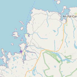
Burtonport railway station served the fishing village of Burtonport in County Donegal, Ireland.
Dungloe railway station was located north of Lough Meela, about 5 km from the town of Dungloe in County Donegal, Ireland.
St Columba's Church, Burtonport is a Catholic church which serves the coastal village of Burtonport in County Donegal, Ireland.
The R259 road is a regional road in Ireland, located in County Donegal. It is a scenic route around the coast of The Rosses, which connects with N56 at both ends.
The R252 road is a regional road in Ireland, located in County Donegal. It runs between Ballybofey and Croaghnashallog, just southeast of Dungloe.
The R250 road is a regional road in Ireland, located in County Donegal.
The R266 road is a short regional road in Ireland, located in County Donegal.
The R260 road is a 1km long regional road in Ireland, located in Ailt a' Chorráin, County Donegal. It runs from Burtonport crossroads to Burtonport Harbour.
The R487 road is a regional road in Ireland, located in County Clare.
CLG Naomh Columba is a Gaelic football-only GAA club based in Gleann Cholm Cille in the south-west of County Donegal in the west of Ulster, the northern province in Ireland. The club fields both men's and ladies' teams from underage as far as senior level. They enjoy an intense rivalry with their neighbours, Cill Chartha (Kilcar), although the rivalry has subdued somewhat in the last number of years as the clubs have played in different divisions.
CLG Naomh Muire is a Gaelic football only GAA club based in Mullaghderg, County Donegal, Ireland, and serves the lower Rosses area. The club fields both men's and ladies' teams at underage to senior level.
Meenachullion is a blanket bog, Ramsar site and national nature reserve of approximately 479 acres (1.94 km2) in County Donegal.
Inishfree (Irish: Inis Fraoigh, transl. 'island of heather') refers to two small islands off the coast of County Donegal in the north of Ireland. Inishfree Upper is the larger of the two at around 0.6 square miles (1.6 km2). It is often known simply as "Inishfree".
CLG Na Rossa is a Gaelic football only GAA club based in Leitir, County Donegal, Ireland. The club fields both men's and ladies' teams at underage to senior level.
CLG Réalt na Mara, or, in the English language, Star of the Sea GAA, is a Gaelic football-only GAA club based in Bundoran, County Donegal, Ireland. The club fields both men's and ladies' teams at underage and, as far as, senior level.
Is uisce beatha déanta ag Comhlacht Drioglann Thír Chonaill, i nDún na nGall, é Croithlí.
website: https://thecrollydistillery.com/
Natura 2000 site ID: IE0000142
Natura 2000 site ID: IE0000165
Natura 2000 site ID: IE0000197
Natura 2000 site ID: IE0004090
Natura 2000 site ID: IE0004110
Cionn Caslach (anglicised as Kincasslagh) is a small Gaeltacht seaside village in the Rosses area of County Donegal, Ireland. Despite only having a population of just over 40 people, the village has attracted much international attention due to the success of local singer Daniel O'Donnell.
Árainn Mhór (English name: Arranmore) is an island off the west coast of County Donegal in Ulster, the northern province in Ireland. Arranmore is the largest inhabited island of County Donegal, with a population of 478 in 2022, but has had a gradually falling native population since the 1990s. Its main settlement is Leabgarrow. The island is part of the Gaeltacht, with most of the inhabitants speaking Ulster Irish.
Croithlí or Croichshlí (anglicised as Crolly) is a village in the Gaeltacht parishes and traditional districts of Gweedore (Gaoth Dobhair) and The Rosses (Na Rossan) in the west of County Donegal in Ulster, the northern province in Ireland. The two 'districts' are separated by the Crolly River (also known as the Gweedore River). It has one convenience shop/restaurant and petrol station and one public house, Páidí Óg's. Crolly is located in two baronies: the Gweedore part of the village is in the Barony of Kilmacrenan, while The Rosses part of the village is in the Barony of Boylagh, the Crolly River being the boundary between the two baronies.
Boylagh (Irish: Baollaigh) is a historic barony in County Donegal in Ireland. Patrick Weston Joyce said the name Boylagh comes from the territory of the O'Boyles. It was created along with Banagh when the former barony of Boylagh and Banagh was split in 1791 by an Act of the Parliament of Ireland.
The Rosses (officially known by its Irish language name, Na Rosa; in the genitive case Na Rosann) is a traditional 'district' in the west of County Donegal in Ulster, the northern province in Ireland. The Rosses has a population of over 7,000 centred on the town of Dungloe, which acts as the educational, shopping and civic centre for the area. Defined by physical boundaries in the form of rivers, as well as history and language use, the area has a distinctive identity, separate from the rest of County Donegal. The extensive district lies between the parish and district of Gweedore to the north and the town of Glenties to the south. A large part of the Rosses is in the Gaeltacht, which means that Irish is the spoken language. The Rosses, Cloughaneely and Gweedore, known locally as "the three parishes", with 16,000 Irish speakers, together form a social and cultural region different from the rest of the county, with Gweedore serving as the main centre for socialising and industry. Gaeltacht an Láir is another Irish-speaking area.
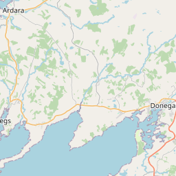
Narin (Irish: An Fhearthainn), also Naran, is a small seaside village and townland in the parish of Ardara on the southwest coast of County Donegal, Ireland. The topography is rough rolling bogland and craggy low hills. Narin Strand is a sand beach approximately two kilometres long. Inishkeel island is located approximately 250 metres from the mainland in Gweebarra Bay and can be reached on foot at low tide by crossing a tidal sand bank. The population of Narin is spread sparsely around the countryside in mostly modern housing. There is a large tourist trade served by several bed and breakfasts and caravan parks. Local amenities consist of a pub, coffee shop and public toilets. There is also an 18-hole golf links with club house. Narin lies at an altitude of 12 metres and lies 8 km north of Ardara, 11 km northwest of Glenties and 13 km south of Dungloe. Brendan Behan stayed with his wife in Narin in 1961, where they spent much time swimming.
Eighter Island (Irish: An tÍochtar) is a small island and a townland off the coast of County Donegal, Ireland. The closest town on the mainland is Burtonport.
Glenties railway station served the village of Glenties in County Donegal, Ireland.
Naomh Conaill CLCG is a GAA club for the Glenties parish in south-west County Donegal. As well as the town of Glenties, the club also covers the area to the village of Fintown and the areas of Kilraine, The Glen and Maas down to the Gweebara Bridge. Much of this area lies within the Donegal Gaeltacht area.
Shallogan's Halt railway station served the area of Straboy in County Donegal, Ireland.
Davy Brennan Memorial Park is the home ground of the Naomh Conaill GAA club, which is located in the townland of Carraigbrac, near the town of Glenties, County Donegal, Ireland. It has also been used to host trials for possible county players.
SM U-110 was a Type U 93 U-boat of the German Imperial Navy (German: Kaiserliche Marine) during World War I. She was ordered on 5 May 1916 and launched on 28 July 1917. She was commissioned on 25 September 1917 as SM U-110. and assigned to IV Flotilla of the High Seas Fleet, based on the German North Sea coast.
Inishcoo (Irish: Inis Cú) is a small island and a townland off the coast of County Donegal, Ireland. The closest town on the mainland is Burtonport.
CLG An Clochán Liath is a GAA club based in An Clochán Liath, a Gaeltacht town along the Wild Atlantic Way in west County Donegal, Ireland. The club fields both men's and ladies' teams at all age grades in Gaelic Football, Hurling, and Camogie.
Ballinamore railway station was a halt which served the village of Ballinamore in County Donegal, Ireland.
Street address: Fintown Taobh Tíre Centre, Baile Na Finne, Co. Donegal, F94 X77V, Ireland (from Wikidata)
Street address: Arranmore Island Taobh Tíre Centre, Ionad an Chrois Bhealaigh, Arainn Mhór, Co. Donegal, F92 YT52, Ireland (from Wikidata)